blah blah blah
Middle Black Mountain
Length: 3.2 miles out-and-backDifficulty (click for info): Easy
Elevation Gain: 1020 feet
Rating (click for info): 3/10
Elevation: 2757'
Prominence: 167'
Driving Directions:
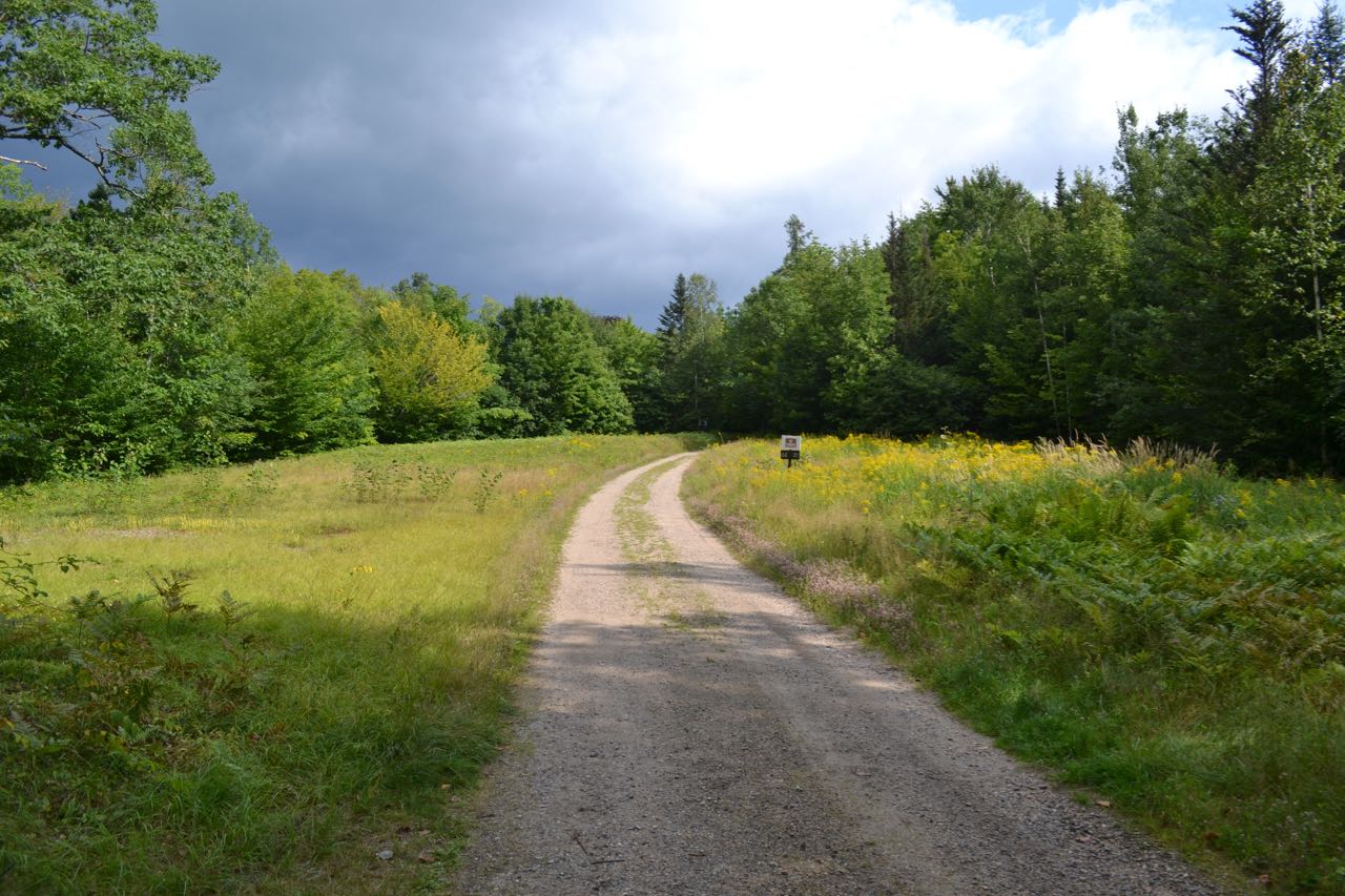
Trailhead and parking area are on Melloon Road in Jackson, NH. To get there, take Rt. 16A to Rt. 16B. Both 16A and 16B are loop routes, beginning and ending in the same area. The south end of 16A leaves the east side Rt. 16 at a covered bridge 2.2 miles north of Rt. 302; the north end is only 0.4 north of the south end. The endpoints of 16B are almost right next to each other and they leave from the middle section of 16A. For the quickest route, take the west end of Rt. 16B. This will be the second end if coming from the south side of 16A (0.5 miles from Rt. 16) and the first end (0.4 miles from Rt. 16) if coming from the north. Once on the correct side of Rt. 16B, drive for 2.1 miles and continue straight onto Carter Notch road as Rt. 16B turns right to continue its loop. Go 1.5 miles on Carter Notch Road, then turn right onto Melloon Road. Melloon Road crosses a bridge, then bears left and continues through a clearing. Park at a signed parking lot on the left, 0.2 miles into the road. For the hiking trail, continue up the road on foot.
About the Hike:
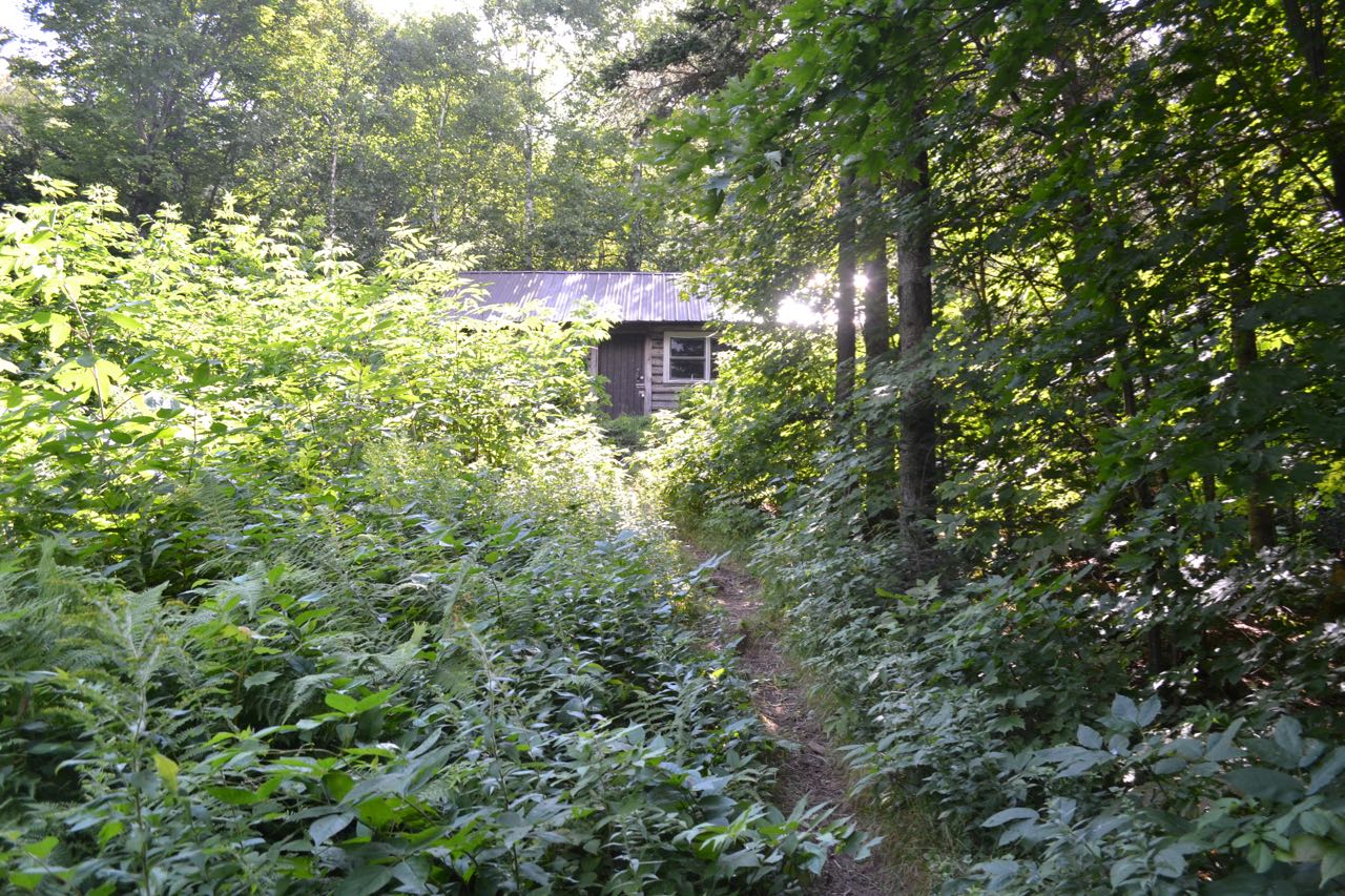
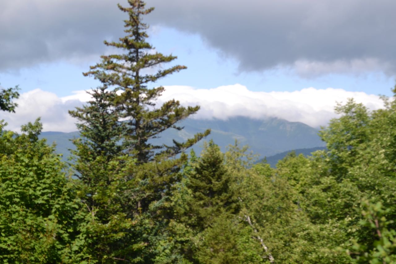
Jackson's Black Mountain is a huge wooded ridge separating Wildcat Brook from the East Branch of the Saco River. Its 3300-foot summit, forming the south side of Perkins Notch near the Coos-Carroll County line, is wild and remote, reached by no trail. Two miles south along the ridge crest is a minor hump referred to as its middle peak. This summit is reached by a backcountry ski trail, coincidentally just north of the chairlift-accessible ski area on Black Mountain's south peak. The main attractions for hikers on the middle peak is a cabin available for rental. The peak used to be highlighted on the famous 52-With-a-View list, but now there are almost no views left at the summit due to tree growth. It is best experienced on a cloudier day when open summits with extensive views are not your target. Or, perhaps, you may one of the kind to seek it out in the winter for a slow climb and more rapid descent.
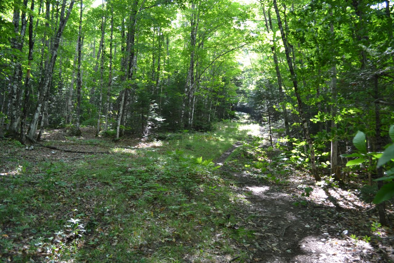
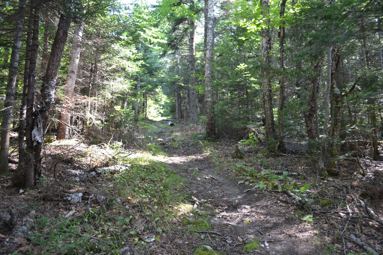
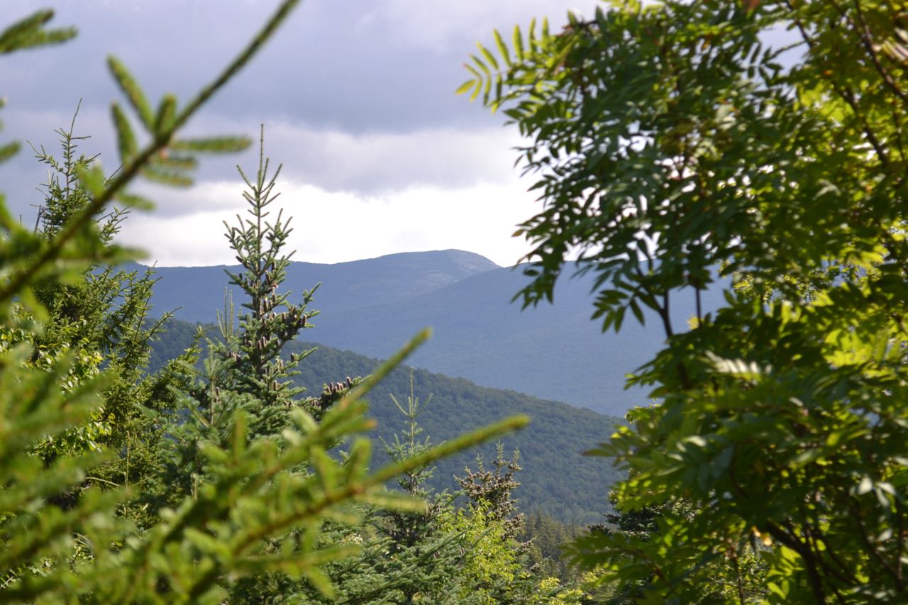
From the parking area, continue down the dirt road into the field, and in less than 0.1 miles, bear right onto the hiking trail/ski trail. The trail starts its climb and quickly passes behind a house. The path is very wide as it climbs steadily. A few small brooks are crossed near the beginning. It angles upward with the uphill slope on the right, then after 0.6 miles, swings around so that the uphill slope is on the left. The second half of the ski trail is steeper than the first. It is another 0.6 miles to the cabin. Once you reach the cabin clearing, the ski trail ends and the hiking trail reaches a junction. From the side of the cabin, you can observe the best view on Middle Black Mountain, a limited look at Mt. Washington over the clearing of the ski trail. To continue to the summit, turn left and follow the hiking trail onto a much narrower path. The trail continues to climb for 0.3 miles, then reaches a junction with East Pasture Trail. Turn left and walk the final short pitch to the summit, a humble rock surrounded by new tree growth which has blocked out almost all views. There are two tiny openings in the trees to look through.
Printable directions page